
We offer you a selection of routes to make your stay in our accommodation more pleasant.
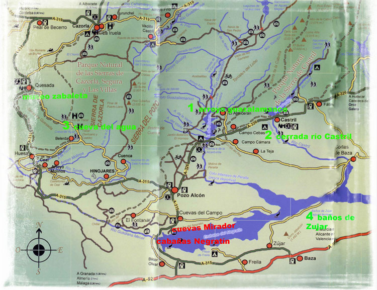
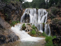
1. Guazalamanco Stream - La Bolera Reservoir.
 .
.
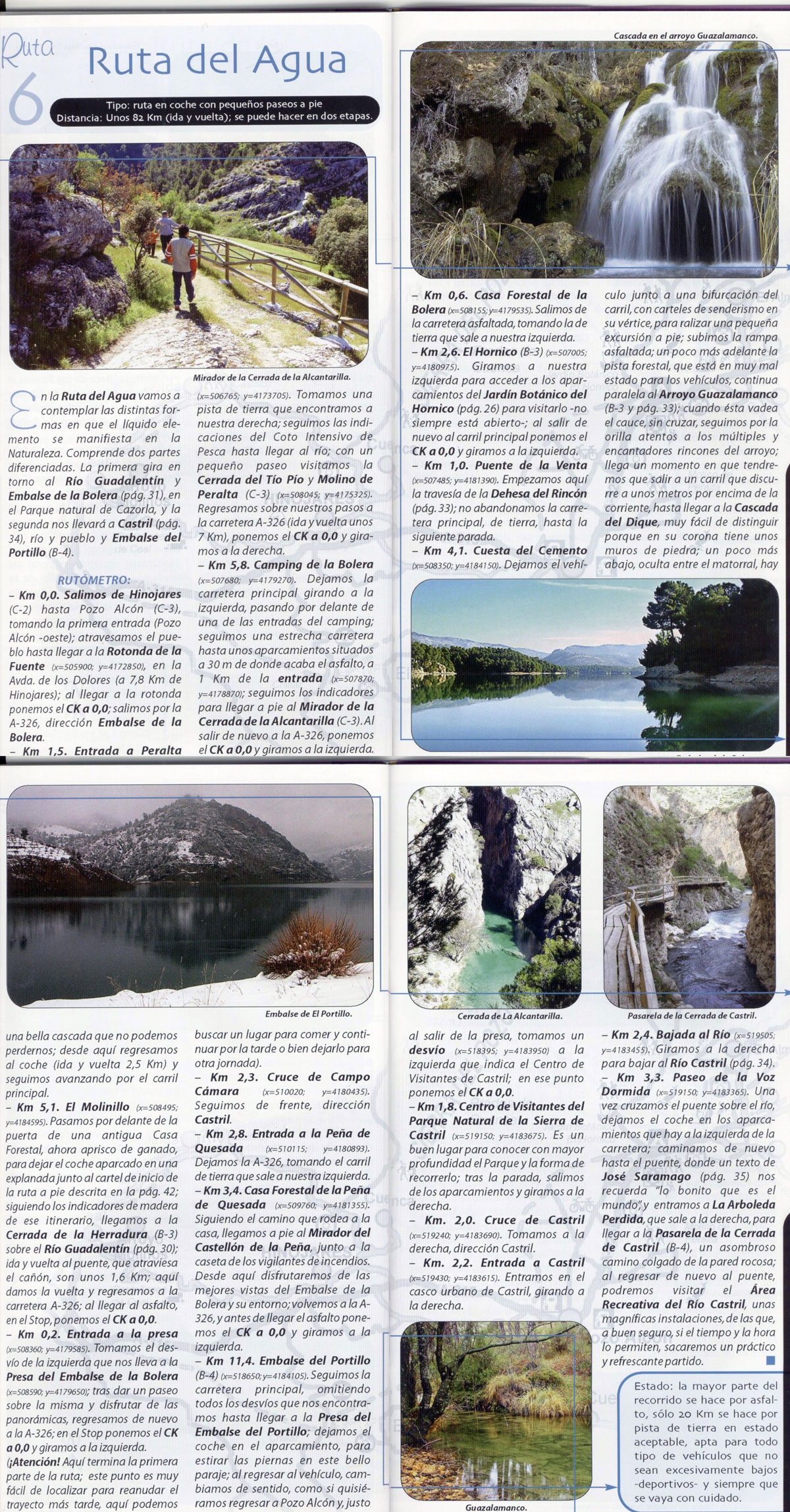
Leaving from our accommodation we set out towards Pozo Alcon and then follow direction to “La Bolera-Castril-Huescar", at about 8 km. we reach “La Bolera campsite”, 500 m. further on, we find a sign indicating“The Hornico and Guazalamanco stream”, we take the path on the left. We set the milometer to zero and 6 km.ahead we find a concrete rampon the left, we leave our vehicle here and start our walking tour, up the ramp and following the road until we reach the stream, keep walking until we find an artificial waterfall and retrace our steps towards “La Bolera reservoir” where we can walk around the lake and its surroundings.We recommend you to visit“La Alcantarilla and Peña Quesada” viewpoints.
2. Footbridge over the narrowing of River Castril and Portillo reservoir.
 .
.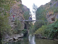
From our accommodation and following the steps of Route 1 (Guazalamanco stream) to La Bolera reservoir, we carry on this road to the village of Castril, before reaching the village we find “The Portillo reservoir” where westop to walk around, stretch our legs and admire this beautiful lake. We continue our way for about 2 km. and reach the village, pass the petrol station and turn right, then turn into the first street on the right again. This road will take us to the river. We leave our vehicle on the left when we get to the river and start the route walking down ”La arboleda perdida” (The lost grove), we arrive to a wooden footbridge over the narrowing of the river, keep walking until we reach a suspension bridge over the river, we cross it and we find a tunnel, we pass it and once outside,we rest before going back to our vehicle.
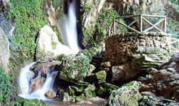
3. Water Cave (Cueva del Agua) -Sanctuary of Tiscar and Zabaleta Museum. cueva del agua pdf
 .
.
From our accommodation we take direction towards Pozo Alcon-Huesa, bordering Pozo Alcon we continue in the direction of Huesa, we pass a petrol station and then turn left towards Quesada.We drive about 14 km. through tight bends but with the road surface in good condition until we get to the place.Before reaching Tiscar, we find a sign on the left indicating “Cueva del Agua". We can also visit the sanctuary of Tiscar a little further on, and we can finish the trip in Quesada, the next village, and visit the museum of the painter Zabaleta.
UTM coordinates
Sanctuary of Tiscar: x = 498035; y = 4180435
Water Cave: x = 498025; y = 4180295
4. Zujar thermal baths.
From our accommodation, we take direction towards Zujar. Once there, we go through the village andcontinue along the same road for about 10 km. It will lead us to a circular shaped restaurant located on the left side of the road.
The thermal pool is placed below the restaurant, above“Negratín reservoir”. Itsdimensions are about 30 m. long and 3,5 m. width. It is partially covered in winter and the entry ticketcosts about 2 € all day.
5. Negratin viewpoint.
We cannot miss this stunning viewpoint where we can gaze at the erosion gullies of Negratin reservoir, the lake itself and Sierra Nevada as background. To get here from Cuevas del Campo we have to take direction towards Zujar and about 3 km. from Cuevas,we will see the sign to turn left onto“Negratin restaurant”.
6-Peralta Spring
We leave from Pozo Alcon towards Castril paying attention to see a sign on the right saying: “Coto intensivo de pesca” (Intensive Fishing Preserve). When we get to the river, we climb until the narrowing and we return. On our way back we will find the springs among lush vegetation.